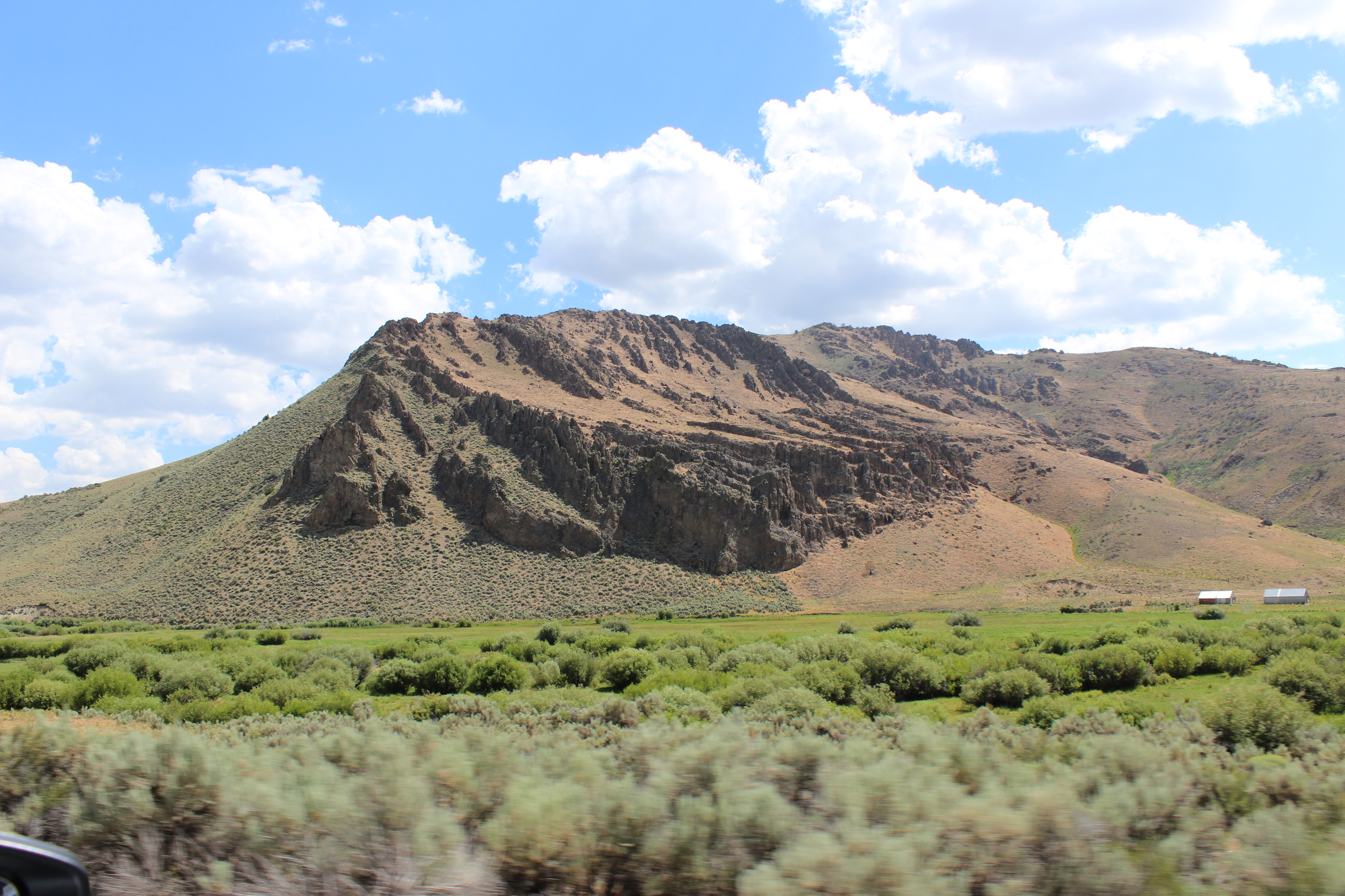
 John Glionna clearly enjoys wandering Nevada. Writing for a variety of publications over the past several decades, including the Los Angeles Times and the Las Vegas Review-Journal, Glionna has sought out stories that speak to him—and his readers. Fortunately, many of his best articles are now collected in a new book titled, “Outback Nevada: Real Stories from the Silver State,” which was recently published by the University of Nevada Press. The book collects some 45 features spotlighting everything from “The Rural Football Team That Rarely Scores,” about the eight-man football team at the remote McDermitt Combined School, to “The Last Sheepherder,” a profile of White Pine County sheepherder Hank Vogler, who has herded sheep for more than three-and-a-half decades. The stories are divided into five geographic sections (the North, the South, the Center, the East, and the West), with each containing seven to ten features. In his preface, Glionna said he began exploring Nevada’s hinterlands in response to people—who didn’t know any better—saying there was nothing out there. Those hinterlands, he wrote, are “where the real Nevada lies.” Among those appearing in the book are Nathan Robertson and Daniel Corona, the youthful mayors, respectively, of Ely and Wendover. In addition to being under 40 years old, both are openly gay. Others profiled included Val Trucksa and Nancy Knighten, two emergency medical technicians operating in Esmeralda County, a place big in size and small in population, who wanted to retire but couldn’t find anyone to take their places, and Boyd Graham, a native Shoshone who is trying desperately to keep his people’s dying Native American language alive. The stories reflect Glionna’s keen eye for recognizing a good story and admirable ability to write something that is poignant when it needs to be, humorous when appropriate, and always respectful of the subject. He has sought out not only the unusual, such as Father Charles Urnick, who conducts weekly mass in the Riverside Hotel and Casino in Laughlin, and Frank Van Zant, who man who built the bizarre Thunder Mountain art project located between Lovelock and Winnemucca, to the inspirational, like historian Wendell Huffman, who is devoted to preserving Nevada’s rich railroad history, and Melissa Mevis, a former addict who is helping other addicts to stay clean in Pahrump. As for why he likes writing about these folks and places, Glionna provided the answer: “Driving north from Las Vegas along U.S. Route 95, I don’t feel I’ve really entered the outback until I’m well north of Indian Springs, when four-lanes narrow to two, as the turnoff toward mysterious Mercury and its tall tales of green men and secret government programs. “Only then does my mind get right, do I stretch my emotional legs and begin to unwind. I see dirt roads that jettison from the blacktop, exploding like laser beams toward the far horizon, and fight the urge to drive every one of them.” For those who appreciate Nevada’s open space, with its majestic mountains and wide valleys, its individualistic and often quirky people, and rich, colorful history, “Outback Nevada” is something to savor and enjoy. “Outback Nevada” is available at local bookstores and from the University of Nevada Press website at www.unpress.nevada.edu/books/?isbn=9781647790448.
Thursday, May 19, 2022
New Book Tells Stories of Real Nevadans
John Glionna clearly enjoys wandering Nevada. Writing for a variety of publications over the past several decades, including the Los Angeles Times and the Las Vegas Review-Journal, Glionna has sought out stories that speak to him—and his readers. Fortunately, many of his best articles are now collected in a new book titled, “Outback Nevada: Real Stories from the Silver State,” which was recently published by the University of Nevada Press. The book collects some 45 features spotlighting everything from “The Rural Football Team That Rarely Scores,” about the eight-man football team at the remote McDermitt Combined School, to “The Last Sheepherder,” a profile of White Pine County sheepherder Hank Vogler, who has herded sheep for more than three-and-a-half decades. The stories are divided into five geographic sections (the North, the South, the Center, the East, and the West), with each containing seven to ten features. In his preface, Glionna said he began exploring Nevada’s hinterlands in response to people—who didn’t know any better—saying there was nothing out there. Those hinterlands, he wrote, are “where the real Nevada lies.” Among those appearing in the book are Nathan Robertson and Daniel Corona, the youthful mayors, respectively, of Ely and Wendover. In addition to being under 40 years old, both are openly gay. Others profiled included Val Trucksa and Nancy Knighten, two emergency medical technicians operating in Esmeralda County, a place big in size and small in population, who wanted to retire but couldn’t find anyone to take their places, and Boyd Graham, a native Shoshone who is trying desperately to keep his people’s dying Native American language alive. The stories reflect Glionna’s keen eye for recognizing a good story and admirable ability to write something that is poignant when it needs to be, humorous when appropriate, and always respectful of the subject. He has sought out not only the unusual, such as Father Charles Urnick, who conducts weekly mass in the Riverside Hotel and Casino in Laughlin, and Frank Van Zant, who man who built the bizarre Thunder Mountain art project located between Lovelock and Winnemucca, to the inspirational, like historian Wendell Huffman, who is devoted to preserving Nevada’s rich railroad history, and Melissa Mevis, a former addict who is helping other addicts to stay clean in Pahrump. As for why he likes writing about these folks and places, Glionna provided the answer: “Driving north from Las Vegas along U.S. Route 95, I don’t feel I’ve really entered the outback until I’m well north of Indian Springs, when four-lanes narrow to two, as the turnoff toward mysterious Mercury and its tall tales of green men and secret government programs. “Only then does my mind get right, do I stretch my emotional legs and begin to unwind. I see dirt roads that jettison from the blacktop, exploding like laser beams toward the far horizon, and fight the urge to drive every one of them.” For those who appreciate Nevada’s open space, with its majestic mountains and wide valleys, its individualistic and often quirky people, and rich, colorful history, “Outback Nevada” is something to savor and enjoy. “Outback Nevada” is available at local bookstores and from the University of Nevada Press website at www.unpress.nevada.edu/books/?isbn=9781647790448.Monday, May 09, 2022
The Story of the Earp Brothers in Nevada
 |
| Virgil Earp |
If one believed all the legends regarding Old West lawmen Wyatt and Virgil Earp in Nevada, he or she might think the pair personally tamed the wild and wooly mining towns of Tonopah and Goldfield—and fought every outlaw in the state.
The reality, however, is the Earp brothers played a fairly minor role in the history and development of the twin Central Nevada communities and only one, Virgil, was ever involved in law enforcement in Nevada.
In January 1902, Wyatt Earp, fresh from Alaska’s mining boom, arrived in Tonopah with his wife, Josie. Within a few months, he and a partner had opened the Northern Saloon and Earp was working for the Tonopah Mining Company hauling ore and supplies.
For a very short time, he apparently worked as an appointed deputy U.S. Marshal in Tonopah, mostly serving papers to defendants in federal court cases—but never engaged with any shootouts with desperados.
In the late summer of 1903, the restless Earp and his wife decided to leave Tonopah. He sold his investments and headed to Los Angeles to live. The two, however, returned several times to prospect around Silver Peak and other parts of Esmeralda County.
And that’s about it for Wyatt Earp in Nevada.
As for Virgil Earp, Wyatt’s older brother, he and his wife, Allie, arrived in Goldfield sometime in the latter part of 1904. Down on his luck and nearly broke, he took a job as deputy sheriff of Esmeralda County and also provided security at the National Club.
Sadly, a few months after settling in Goldfield, Virgil Earp contracted a bad case of pneumonia, which he was unable to shake. On October 19, 1905, Virgil Earp died in Goldfield at age 62. At the request of his daughter, his remains were sent to Portland, Oregon and he was buried at the Riverview Cemetery.
It is believed that Wyatt and Josie Earp may have visited Virgil and Allie in Goldfield sometime during the summer of 1904, but there is no official record of such a visit.
Nevada State Archivist Guy Louis Rocha, who has co-authored a book on the Earp brothers in Nevada, has written: “As for Wyatt Earp, there is no end to the list of things he didn’t do in Goldfield. He didn’t tend bar there, he didn’t own a hotel or saloon there, and in fact he didn’t do much of anything there.”
In total, the two Earp brothers spent about eight and eleven months, respectively, in Nevada—hardly enough time to accomplish everything that has been attributed to them.
Still, the apocryphal stories about Wyatt Earp in Tonopah make for fun reading. For instance, one of the most often repeated stories involves him coming to the rescue of Tonopah attorney Tasker Oddie, who later served as Nevada’s Governor and U.S. Senator.
In the tale, claim jumpers were digging a shaft on land owned by Oddie’s clients. In order to stop the men from continuing, the unarmed Oddie jumped into the hole. The men allegedly pulled their guns on Oddie and ordered him to leave.
At that moment, Wyatt Earp and his saloon partner, Al Martin, came along in a wagon. The famous former lawman, who sometimes worked for Oddie, quickly sized up the situation and jumped into the hole beside his friend.
When the claim jumpers asked who he thought he was, Earp reportedly said, “I’m Wyatt Earp,” then pointed at Martin, who had a shotgun aimed at the mine thieves. The men lowered their guns and quickly scrambled out of the hole—but not before following Earp’s orders to replace the mine location stakes they’d knocked over.
The great Nevada mythmakers, Lucius Beebe and Charles Clegg, wrote about a remarkably similar episode occurring on a train ride. Allegedly, union thugs decided to shoot Oddie, who worked for the mining companies.
“A walrus mustached individual in a slouch hat and neat dark suit who was lounging in the smoking room overheard two characters in an adjacent compartment planning to shoot Oddie through the partition as soon as the train got under way,” Beebe and Clegg wrote.
“Unceremoniously, he kicked open the door of their bedroom and told them the project was ill-advised and they had better leave the train while the going was good. To their inquiry as to just who the hell he thought he was, the answer was simply, ‘Wyatt Earp.’ The assassins left.”
To find out what really is known about the Earps in Nevada, pick up a copy of “The Earps’ Las Frontier,” by Jeffrey M. Kintop and Guy Louis Rocha or read “Wyatt Earp: Law, Order, and a Game of Chance,” which appeared in the March/April 2016 issue of Nevada Magazine.
Monday, May 02, 2022
When the Russians Came to Northern California

An odd item that has been in the news lately because of the situation in Ukraine has been a Russian lawmaker’s apparent demand that the United States return the state of Alaska to it. The U.S. purchased Alaska from the Russians for $7.2 million in 1867.
While the claim is ludicrous, it is true that more than a century ago Russia controlled a portion of Northern California. In the early 19th century, the Russian government cut a deal with Spain, which, at the time, had claim to the entire Western U.S. region, to permit it to have a small colony on the northern coast of California.
The Russians were interested in the area because of its economic potential, the fact it would allow trade between Russia and Spain, and it could provide much-needed supplies to Russian colonies in Alaska.
The short growing season in Alaska and the dangerous journey from Russia in the winter months, when supplies were most needed, caused the Russians to look south for a more year-round farming and trading base.
In March 1812, the Russian-American Company, a fur-trading arm of the Russian government, established Fort Ross, a small colony on the coast of Northern California, a few miles north of Bodega Bay.
Today, a monument to those days can be found at Fort Ross State Historic Park, located about an hour and a half north of San Francisco (12 miles north of Jenner) via scenic Highway 1, which runs along the California coast.
By September of 1812, the Russians had constructed a redwood stockade complex at Fort Ross, which included blockhouses with cannons, several log homes, storage buildings, barracks, an armory and, in 1825, a traditional Russian Orthodox chapel.
According to history books, the name “Ross,” was derived from a then-current literary word for Russia (“Rossiia”). In fact, the settlement wasn’t built to be a military outpost but rather a commercial trading post and was generally referred to it as “Ross Office” or “Ross colony” by the Russians.
In addition to the stockade, a number of dwellings were built outside of the walls of the complex by native Alaskans, who had traveled south with the Russians, as well as several of the indigenous Pomo Indians, who chose to work at the fort.
By 1828, more than 200 Russians, Alaskans and Native Americans lived at the colony. Other businesses and structures also had appeared by this time, including a bakery, a cattle yard, windmill, farmhouses, gardens and orchards (which still exist).
The colony’s value as an agricultural base was limited because of its location next to the sea. Fog, poor crop selection and pesky gophers destroyed many of the crops, so, in 1833, the Russians established three ranches farther inland, which proved more fruitful.
Fort Ross was somewhat viable, however, in other areas of commerce such as livestock, logging, seal fur hunting and manufacturing related products (tallow candles, wool blankets, leather goods, lumber).
Despite its modest success, the Russian-American Company decided in 1839 to abandon the colony. The primary reasons seemed to be that the seal population in the region had been mostly exhausted, and trade in manufactured goods and agriculture fell below expectations.
Additionally, expansion into the area by American and Mexican settlers meant that Russia would have to protect its holdings—something it was ill equipped to do because of the great distance between the colony and motherland.
In 1841, Captain John Sutter, founder of Sacramento and de facto landlord of central California, agreed to purchase the buildings and equipment of the Russian-American Company but, apparently, not the land, which was claimed by the Mexican government (which, by this time, had succeeded Spain as the region’s overseer).
Over the next several decades, the settlement was sold several times and used as a ranch, hotel, saloon and dance hall. In 1906, the crumbling remains of the old fort were deeded to the State of California.
Since then, the fort has become part of the California State Park system and most of the buildings have been rebuilt and restored.
Visitors today will find a fascinating look at one of the more interesting episodes in California's history. Wandering through the fort, you can’t help but feel it is some kind of alien presence on California soil because of its distinctive Russian architecture, particularly the chapel with two cupolas.
A modern visitors center, located above the fort, offers informative displays and a slide show detailing the region’s Pomo population as well as Russian exploration and settlement in the American west.
A self-guided walking tour, supported by an informational brochure, prompts you through the compound. Informative signs in each building provide detail of what you’re viewing.
Fort Ross is open daily from 10 a.m. to 4:30 p.m. For more information, go to www.fortross.org/info.
Thursday, April 21, 2022
Before Ely—There was Lane City

The remnants of one of White Pine County’s earliest communities, Lane City, can still be seen just west of Ely.
In fact, Lane City, originally known as Mineral City, is considered one of the area’s first significant settlements. It was established several years earlier than Ely.
According to Nevada historian Shawn Hall’s book, “Romancing Nevada’s Past: Ghost Towns and Historic Sites of Eureka, Lander and White Pine Counties,” a local Native American guided a prospecting party led by Thomas Robinson to promising silver deposits in the region in late 1867.
The discovery led to the creation of the Robinson Mining District in March 1868 and within two years a small community had cropped up, which was named Mineral City.
To process all of the silver being mined in the district, a 10-stamp mill and a small smelter were built in city, which grew to nearly 600 residents in 1872-73. According to Hall, Mineral City also had a post office, six saloons, four boardinghouses and a handful of shops and stores.
Despite a drop in silver production, beginning in 1874, Mineral City managed to survive for several years as a regional hub for mining operations in the county.
By 1880, however, it was clear that Mineral City’s boom had gone bust, and most of its residents began to wander off to more lucrative mining opportunities.
The district, however, revived in 1896, when Charles D. Lane, a wealthy Eastern investor, purchased many of the local claims, reopened the stamp mill and constructed a power plant and water ditch. It was during this time that Mineral City’s name was changed to Lane City.
During the next decade and a half, the area’s mines and mining operations sporadically operated, depending on whether enough ore could be found and processed.
By 1910, Lane City’s mines were largely shut down for good. The post office, which had reopened in 1902, closed again in 1911.
Because of the success of copper mining in nearby Ruth, Lane City, however, wasn’t completely abandoned as a number of miners continued to live in the community and work in the adjacent mines or in Ely.
Throughout the first part of the 20th century, Lane City boasted about a dozen homes and a fine brick schoolhouse, which, while long abandoned, remains standing.
Today, visitors to Lane City can find a handful of stone, frame and log buildings as well as some stone walls and foundations, all of which date to the early 20th century. It’s not believed that any of the original structures from the settlement’s earliest days (when it was still called Mineral City) still exist.
Lane City is located three miles northwest of Ely, on the east side of U.S. 50. The ruins are accessible via a dirt road. Be aware, however, that much of the area is private property and there are some open mine diggings.
One of the best ways to get a good look of the ruins of Lane City is to take a ride on the Nevada Northern Railway, which operates a regular excursion between its depot in East Ely and Ruth.
From the train, you can clearly see the dozen or so ruins as well as a few homes that appear to still be inhabited. The most impressive structure is the old Lane City School, which is the large, white building that sits near the front of the community and almost looks like it could be reopened tomorrow.
For more information about Lane City, pick up a copy of Shawn Hall’s book, published by the University of Nevada Press, or June Shaputis’ informative history of the community, found at: http://theusgenweb.org/nv/whitepine/Towns/lane_city.htm.
Tuesday, April 12, 2022
Exploring the New East Walker River State Recreation Area

One of Nevada’s newest state parks facilities is all about ranching.
Known as the East Walker River State Recreation Area, located about 14 miles south of Yerington, the park is devoted to celebrating the ranching culture of western Nevada, while offering plenty of recreational opportunities.
The park, along with Ice Age Fossil State Park near Las Vegas, are the only new state parks that have been established in the past two decades.
The East Walker River Recreation Area encompasses nearly 30 miles of river corridor and 12,856 acres of land. It was created when the Walker Basin Conservancy, a non-profit environmental group seeking to restore Walker Lake, bought four historic ranches that border the East Walker River.
According to the group, the goal was to secure the water rights from the ranches in order to return more water to the lake, which has been receding in recent decades. The group gifted the land, estimated to be worth more than $8 million, to the state for the park.
The ranches included the Pitchfork, Nine Mile, Rafter 7 and Flying M ranches, which can trace their roots back more than 125 years.
At the present time, only the Pitchfork (originally known as the Strosnider Ranch) and the Nine Mile are open to the public.
The Flying M Ranch, owned by Barron Hilton, remains under a life lease and will become available for public use after his death. The Rafter 7 Ranch, which includes a large ranch house, is still being developed as a large-group setting.
The initial phase of the park’s development began on the Pitchfork Ranch property in 2018, with the opening of a visitor’s center (in an attractive stucco building that was the original ranch house) and completion of campsites, some with RV hook-ups, and covered picnic areas.
Additionally, the park offers four one bedroom, one-bathroom cabins (with additional bunkrooms accommodating two twin bunkbeds) at a place called Antelope Acres, which is about a mile and a half from the main entrance.
Cabins can be reserved using a form found on the state park service web site (http://parks.nv.gov/parks/walker-river). Cabins cost $95 per night on week nights and $120 for weekends.
A stop into the visitor’s center is a chance to ask park staff any questions about the area, view a handful of exhibits, and pay the $5 day-use fee.
One of the best ways to enjoy the park is by kayaking on the East Walker River (bring or rent your own). Currently visitors can float for about six miles but the route will eventually stretch some 50 miles.
A good account about kayaking at the park recently appeared on Public Broadcasting’s Wild Nevada television show (watch at: www.pbsreno.org/watch/wildnevada/s5-episode1/).
The park also offers trails as well as roads for off-road vehicles, horseback riding, mountain bikes. Private working ranches surround the park’s property, so pay attention to signs marking no trespassing.
To reach East Walker River Recreation Area, head south of Yerington on State Route 208 for about eight miles, then head east on a marked, graded dirt road for another six miles or so. The road can be wash-boarded and a little rough for passenger cars but easy for a higher clearance four-wheel drive vehicle.
For more information, go to the Nevada State Park web site for the park, which is: http://parks.nv.gov/parks/walker-river.
Wednesday, April 06, 2022
The Sweet Surprise that is Wilson Canyon

Wilson Canyon is a narrow rock passageway in the Singatse Range, which separates Smith Valley from Mason Valley in western Nevada. Stretching some three miles, the canyon is an unexpected scenic treasure that is also popular with off-road vehicle enthusiasts.
The canyon’s spectacular reddish-gray-colored volcanic rock walls were carved by the West Walker River, which runs through the canyon before intersecting with the East Walker River a few miles to the east.
Located 13 miles southwest of Yerington, Wilson Canyon was named for brothers David and William “Uncle Billy” Wilson, who settled in the area in 1863.
David, Wilson who was born in Ohio in 1829 and raised in Missouri, headed to California in 1850 to seek his fortune as a gold placer miner on the Yuba River. Three years later, he returned to Missouri and, in 1855, married Abigail Butler of Ohio.
Following service in the Union Army during the Civil War, David Wilson and his wife and family returned to the west, this time heading to Nevada, where his brother, William Wilson, was mining.
The brothers settled in the Wilson Canyon/Mason Valley area, where David became a successful rancher while William, who had previously worked as a miner in Virginia City, continued to seek his fortunes in the region’s mountains.
In 1866, William struck it rich in the Pine Grove area. While David would spend the rest of his life in the Mason Valley area, becoming a prominent rancher and community leader, William made and eventually spent a fortune developing mining properties in Pine Grove.
William died nearly penniless in Pine Grove in 1911 at the age of 80. His brother, David, died four years later in the Mason Valley home of his friend, John McGowen, at the age of 85.
An interesting side note is that in addition to his own sons, David Wilson took in and raised a young Northern Paiute boy named Wovoka, who also took the name Jack Wilson. Wovoka would later become an important Native American religious figure and leader, who started the Ghost Dance Movement in 1890.
From 1910 to the late 1940s, the Nevada Copper Belt Railroad line ran through the canyon.
In more recent decades, the Bureau of Land Management has maintained a recreation area for day-use and overnight camping, which is located at the western edge of the canyon. Camping is primitive with no utility hook-ups and on-site vault restrooms.
The recreation area is popular with all-terrain vehicle enthusiasts and dirt-bikers, who can travel on some three-and-a-half miles of trails in the area.
Additionally, the Wilson Canyon Nature Trail, developed in 2011 with assistance from the state of Nevada, Lyon County and local volunteers, is a 3.5-mile loop that offers beautiful views of the area.
Lining the trail, which is rated moderate, are a handful of signs that help hikers identify various plants and animals (including mule deer, waterfowl and raptors, found in the area. You will also find petrified wood stumps and other fossils along the way.
For more information about Wilson Canyon, go to: www.alltrails.com/trail/us/nevada/wilson-canyon.
Monday, March 28, 2022
Glimpses of Early Reno Still Found in Historic Powning's Addition Neighborhood
 |
| Reno's McKinley School |
In recent years, more and more attention is being paid to a Reno neighborhood known as Powning’s Addition. Directly west of downtown Reno and north of the Truckee River (roughly bordered by Keystone Avenue, Commercial Row, Arlington Avenue and Riverside Drive), the area contains some of the community’s most historically-significant structures.
The neighborhood takes its name from Christopher Columbus (C.C.) Powning, one-time owner and editor of the Nevada State Journal newspaper, who served as the primary force behind its development.
Powning, who is now largely forgotten, owned the newspaper from 1871 to 1891, and also served as president of the Reno Water, Land and Light Company, the main utility provider for the community.
In 1886, Powning purchased 122 acres of land west of the downtown, which he divided into lots and began selling under the name, Powning’s Addition.
According to historical records, while sales were steady in the beginning, with a number of Italian families locating in the new neighborhood, construction was stop-and-go because of Nevada’s roller coaster economy, which, at the time, was so dependent on mining.
As a result, homes were built in the subdivision over a five to six-decade period (from the 1890s to the 1940s). Construction styles varied with early houses built with a Queen Anne design (popular in the late Victorian period) and later homes largely being Craftsman bungalows, a style popular in the 1930s.
Additionally, commercial development began to appear along First and Second streets, which intersect the tract, due to the increasing popularity of the automobile, particularly after the development of the Lincoln Highway, which passed through downtown Reno.
Today, Powning’s Addition is a mixed-use neighborhood with many quaint historic homes, some still used as residences, surrounded by office buildings, apartments, commercial developments, and elegant houses that have been converted into businesses.
Several years ago, Nevada historical writer Patty Cafferata produced an excellent walking tour booklet (“A Walk Through Time: The Historic Powning’s Addition in Reno, Nevada”) that listed some two dozen noteworthy sites in Powning’s Addition, including:
• The McKinley Park School at 925 Riverside Drive. This beautiful Mission Revival-style school, now an arts center, was erected in 1909-10. The school was one of Reno’s “Spanish Quartet” schools, designed at the time by noted Nevada architect George Ferris in a Mission Revival style. Today, McKinley and Mount Rose Elementary School still survive.
• The Pearl Upson House, 937 Jones, is a good example of the Queen Anne-style architecture. This red brick, two-story house was built in about 1902 by Mr. and Mrs. Pearl Upson and still serves as a private residence.
• Dow House, 935 Jones, is another classic red brick Queen Anne, built about the same time as the Upson home. It boasts a wrap-around porch and is currently used as an office.
• Rocovits Gas Station, 100 Winter, considered Reno’s oldest gas station. The gas station, believed to have been constructed in 1914, was one of the early commercial businesses built in Powning’s Addition.
• Dondero Property, 96 Winter and 98 Winter, is a prime example of some of the development by Italian-American homeowners. The brick bungalow at 96 Winter served as the residence of Archangelo and Amelia Dondero, the first Italians to own a business in downtown Reno (“The Northerner” saloon on Center Street, now part of Harrah’s). The two-story building behind the house, at 98 Winter, was a boarding house for Italian immigrant railroad workers.
• Lora J. Knight House, 615 Jones, is a magnificent home and matching cottage that was built in 1931 by a prominent Southern California philanthropist. Mrs. Knight, who also built the Vikingsholm mansion at Lake Tahoe, accommodated guests here before they made the long journey to Lake Tahoe. Over the years, it has been remodeled extensively and is currently used as offices.
• St. Thomas Aquinas Church, 310 West Second, is an impressive cathedral built in 1907 and rebuilt in 1910 after a fire. It utilizes a blending of architectural styles, including Renaissance, Classical and Baroque and remains in use as a Catholic Church.
Unfortunately, “A Walk Through Time: The Historic Powning’s Addition in Reno, Nevada,” is out of print but it can occasionally be found on online used bookseller sites.
Subscribe to:
Posts (Atom)
Reno's Pioneering Female Journalist: The Incomparable Peggy Trego
Peggy Trego's Unionville There’s a house at the top of Buena Vista Canyon, in the near-ghost town of Unionville, that is still known ...

-
 For years, Virginia City billed itself as “the West’s Liveliest Ghost Town.” So, it’s not surprising that the former mining town would be th...
 -
 For more than quarter century, travelers heading west on Interstate 80 knew they had reached the city of Sparks when they passed a big grave...
 -
Toquima Cave While I’ve been fortunate enough to have traveled a good deal of the state of Nevada during the past couple of decades, there a...
