Author Sessions S. Wheeler once wrote that Nevada “has a spectacular beauty—great, jagged mountains of banded limestone rising high above desert valleys . . . to some it is austere and frightening; to others it has a lonely grandeur, which is friendly and comforting.”
That perfectly describes Nevada’s Monitor Valley. Situated in the geographic center of the state, about halfway between Austin and Eureka, the valley is a long, narrow stretch of land that is bordered by the Monitor Range on the east and the Toquima Range on the west.
The valley is about 70 miles long and perhaps ten miles wide and runs in a north-south direction. While no paved roads run through it, there are a number of maintained dirt roads that are drivable in a four-wheel drive or high clearance vehicle, particularly in the drier months, including Monitor Valley Road (State Route 882; also called the Old Belmont Road), which runs through the center of the valley from U.S. 50 (at the north end) to the mining town of Belmont (the southern point).
The Monitor Valley Road, accessed from U.S. 50 at a point about 25 miles from the intersection of U.S. 50 and State Route 376, offers a chance to literally escape from the modern world. This ribbon of packed gravel and dirt leads deep into a landscape more noteworthy for what is not there than for what is there.
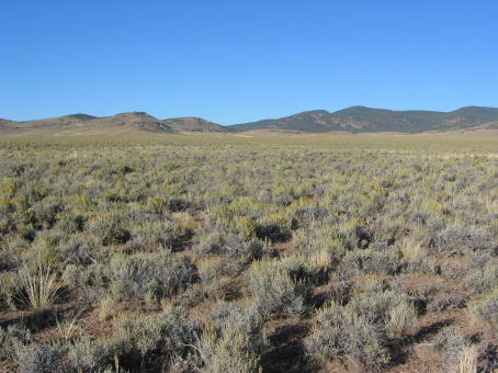
The journey takes you through spectacularly empty country that is the essence of Nevada’s high desert beauty. This a terrestrial canvas painted with subtle shades of soft green, delicate brown and yellow and muted blues and grays.
The road passes the actual geographic center of Nevada (at about the 13-mile mark) and continues toward the fairly extensive ruins of the Potts Ranch. The ranch was apparently established in the 1870s by William Potts and became one of the larger cattle operations of the time. In the late 1890s, it gained its own post office.
The ranch, however, was sold in the 1940s and the buildings appear to have been abandoned since then. Today, you can still see the remains of an impressive, two-story ranch house, a couple of stone storage buildings, and the foundations and walls for a handful of other structures.
The ranch, which remains a functioning cattle operation—so respect the fact it is private property—also contains hot springs, several of which consist of steaming ditches or holes filled with scalding hot water covered by a layer of green algae.
During our drive, we stopped near the ranch to admire the spectacular views of the sagebrush-dotted valley and sloping mountain ranges. In the stillness of the late morning, it was easy to imagine what it must have been like to live or work at the Potts place a century ago.
A special surprise was driving a bit farther and stopping to watch a herd of wild horses. About a dozen brown, black and white mustangs grazed peacefully, ignoring us as we snapped a few photos.
We intersect with another road, which leads to the west. This is the route that leads into the Toquima Range to Toquima Cave, one of the best sites of Indian pictographs in the state, before dropping down into the Big Smoky Valley.
Resuming our journey, we continued by the alkali mound that is the site of Diana’s Punch Bowl. At the top of the hill is the large opening—the Punch Bowl—that contains bubbling hot geothermal water.
From here, the main road passes by several smaller roads that lead to isolated ranches, some fairly large. Both right and left are the mountains that, with their various peaks, cliffs and undulations, hint of hidden, secret places waiting to be explored.
The road gradually drifts to the west as it heads toward the once-bustling mining town of Belmont. The first indication that civilization is around the corner is when you pass the ruins of a large brick-manufacturing plant. The site contains the large foundations and walls of the factory as well as a tall, red brick smokestack.
From here, the road meanders by some newer homes as well as dilapidated wooden shacks before it drop down into Belmont and out of the Monitor Valley.
Despite the fact that Belmont only has about a dozen or so residents, it seems crowded compared to where we’d just been.


Very informative post. I am preparing to bike the Monitor Valley with my dog, Chiva. Your descriptions and tales have inspired me to take this route. Please let me know if you have any other suggestions for us while we are in Nevada.
ReplyDeleteThank you,
David
www.tourdedog.org